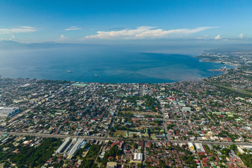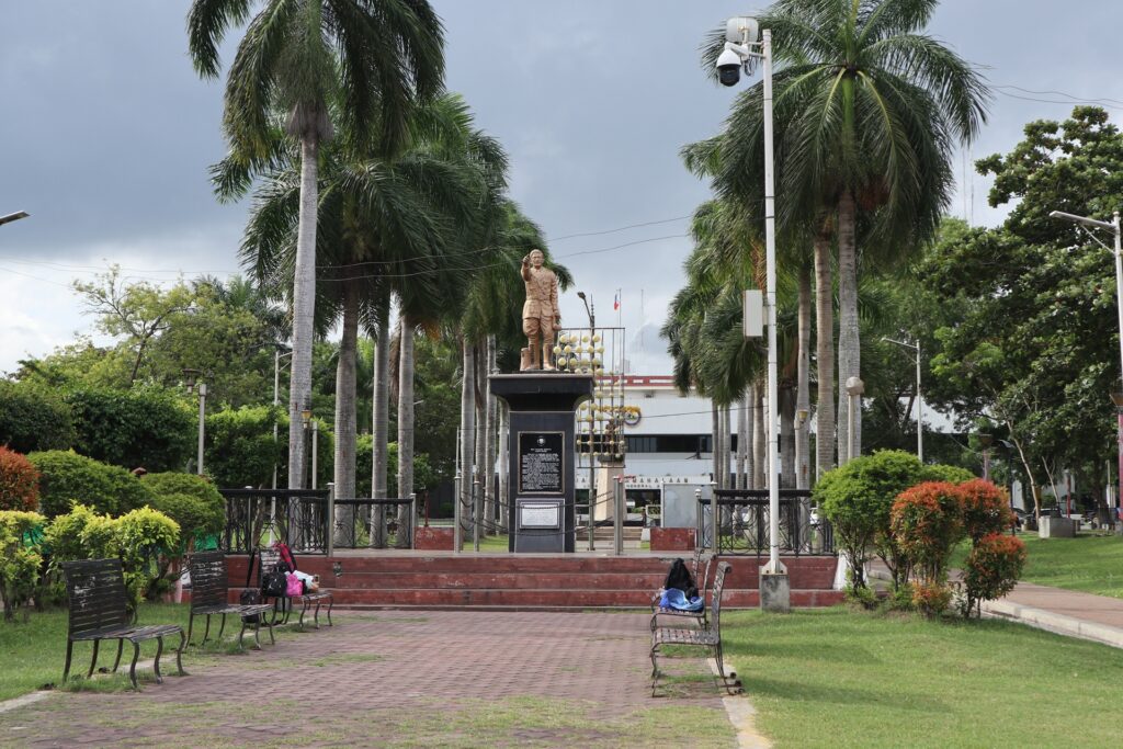
General Santos is divided into smaller local communities called barangays. In the Philippines, a barangay is the smallest unit of local government, similar to a neighborhood, district, or village, depending on the area. Barangays help organize local services, community concerns, public programs, and everyday life.
Understanding the barangays of General Santos helps you see the city beyond the usual visitor spots. Each barangay has its own role, character, and local importance, whether it is residential, commercial, coastal, agricultural, or part of the city’s expanding urban area.
For visitors, new residents, or anyone learning about GenSan, knowing its barangays gives a clearer picture of how the city is organized and how people actually live across different parts of it.
Let’s start with the barangays of General Santos City, listed alphabetically:
- 1. Barangay Apopong
- 2. Barangay Baluan
- 3. Barangay Batomelong
- 4. Barangay Buayan
- 5. Barangay Bula
- 6. Barangay Calumpang
- 7. Barangay City Heights
- 8. Barangay Conel
- 9. Barangay Dadiangas East
- 10. Barangay Dadiangas North
- 11. Barangay Dadiangas South
- 12. Barangay Dadiangas West
- 13. Barangay Fatima
- 14. Barangay Katangawan
- 15. Barangay Labangal
- 16. Barangay Lagao
- 17. Barangay Ligaya
- 18. Barangay Mabuhay
- 19. Barangay Olympog
- 20. Barangay San Isidro
- 21. Barangay San Jose
- 22. Barangay Siguel
- 23. Barangay Sinawal
- 24. Barangay Tambler
- 25. Barangay Tinagacan
- 26. Barangay Upper Labay
- Wrap-Up
1. Barangay Apopong
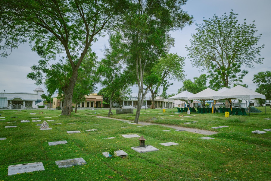
Here are some local spots to check out:
- Citi Hardware: A major hardware and home‑improvement store.
- New Society Market: A busy public market serving Apopong and nearby barangays.
- St. Peter & Paul Parish: The main Catholic church serving the community.
- Forest Lake Memorial Park: A landscaped memorial park offering peaceful green spaces.
Barangay Apopong is one of General Santos City’s major inland barangays and an important residential area on the northern side of the city. It is known for its mix of subdivisions, housing communities, schools, churches, small businesses, and local transport routes.
Compared with the more commercial barangays near the city center, Apopong has a stronger neighborhood character, with many areas shaped by family homes, roadside stores, eateries, and community facilities.
Its location makes it a practical gateway between urban GenSan and interior routes leading toward upland communities and nearby areas outside the city proper. This gives Apopong a steady flow of commuters, workers, students, and residents moving through the barangay each day.
Apopong has also become associated with the city’s residential expansion, with several estates and housing developments found in and around the area.
While it is not a tourist-focused barangay, it is significant in understanding how General Santos has grown outward from its commercial core into larger suburban communities.
Its value lies in everyday city life: settlement, mobility, local commerce, and the continuing development of GenSan’s inland neighborhoods.
2. Barangay Baluan
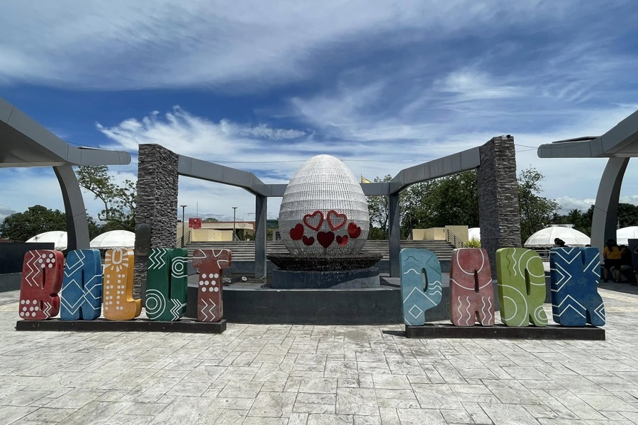
Here are some local spots to check out:
- Baluan Balut Park: A small community park known for its balut heritage.
- Baluan Barangay Hall: The main civic and administrative center of the barangay.
- St. Patrick Church: A local Catholic church serving the Baluan community.
- Baluan Philcam Church: A neighborhood Christian church and gathering place.
Barangay Baluan is one of the larger and more recognizable barangays in General Santos City, located on the eastern side of the city. It is strongly associated with residential growth, local commerce, and access toward neighboring areas outside the city proper.
Because of its position along major routes, Baluan serves as both a settlement area and a movement corridor for residents, commuters, and businesses.
The barangay has a mix of subdivisions, roadside establishments, schools, churches, small markets, food spots, and service-oriented businesses. In recent years, Baluan has become increasingly developed, with more housing areas and commercial activity appearing along its main roads. This makes it one of the barangays that reflects GenSan’s outward urban expansion.
Baluan is also known for its community facilities and open spaces, including areas used for local events, sports, and barangay activities. While it is not primarily a tourist destination, it is an important part of daily city life.
Its value comes from its role as a residential and transit barangay, connecting people to schools, workplaces, markets, and nearby communities while continuing to develop as one of GenSan’s active suburban districts.
3. Barangay Batomelong
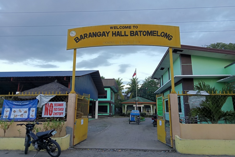
Here are some local spots to check out:
- Batomelong Barangay Hall: The main administrative and civic center of the barangay.
- Batomelong Covered Court: A community sports venue used for events and gatherings.
- Batomelong Mosque: A local place of worship serving the Muslim community.
Barangay Batomelong is one of the inland barangays of General Santos City, located away from the dense commercial activity of the city center.
It has a more rural and open character compared with the highly urbanized barangays, with areas used for homes, small farms, local roads, and community facilities.
Its setting gives it a quieter atmosphere, making it part of the city’s wider agricultural and residential landscape. Batomelong is connected to the city through interior routes that serve residents, workers, and small local businesses.
The barangay’s development is more community-based than commercial, with sari-sari stores, small eateries, chapels, schools, and barangay facilities forming much of its everyday environment.
Its value lies in showing the less urban side of General Santos. While GenSan is often associated with tuna, malls, ports, and business districts, barangays like Batomelong reflect the city’s inland settlements, where residential life, open land, and local agriculture remain important.
It is a barangay shaped by space, community ties, and gradual development rather than heavy commercial concentration.
4. Barangay Buayan
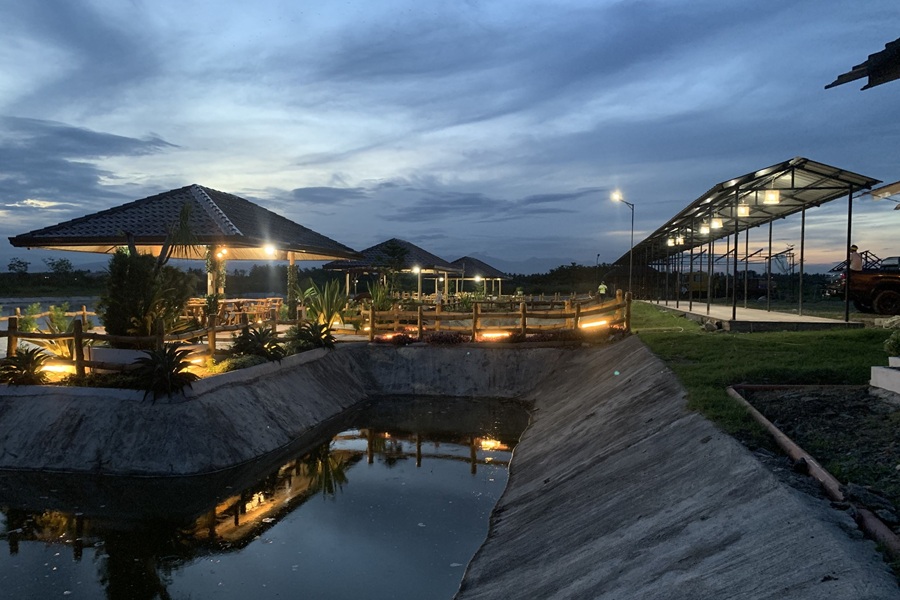
Here are some local spots to check out:
- Rajah Buayan Air Base: A Philippine Air Force base serving as a key military facility in Buayan.
- Oranza Gym: A local community gym used for sports, events, and barangay activities.
- Metro Gensan Shooting Range: A recreational shooting range offering training and practice sessions.
- Patricio’s Coco Island: A small resort‑style venue known for coconut‑themed huts and casual gatherings.
Barangay Buayan is one of the historically important names in General Santos City, closely linked to the older identity of the area before the city became widely known as GenSan.
The name “Buayan” is associated with the original municipal name Buayan, which was used before the city was renamed in honor of General Paulino Santos. Because of this, the barangay carries historical value as part of the city’s early civic identity.
Today, Buayan is a coastal and industrially significant barangay, with strong connections to fishing, trade, storage, and transport activity. Its location near the coast and key access routes makes it important to the movement of goods and people.
The area includes residential communities as well as commercial and industrial establishments connected to GenSan’s wider economy. Buayan also reflects the layered development of General Santos: from older settlement and municipal history to modern urban and economic activity.
It is not only a residential barangay, but also part of the city’s working landscape, where coastal access, transport, livelihood, and local history meet.
5. Barangay Bula
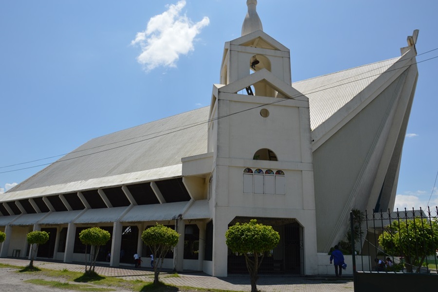
Here are some local spots to check out:
- Sto. Niño de Bula Parish: The primary Catholic church serving the Bula community.
- Bula National School of Fisheries: A key educational institution located inside Bula.
- Blue Bubbles Resort: A small local resort with pools and family‑friendly amenities.
- Bula Beach: A simple community beach area used for swimming, walks, and seaside gatherings.
Barangay Bula is one of the coastal barangays of General Santos City and is closely tied to the city’s fishing identity. Its location near Sarangani Bay gives it a strong connection to marine livelihood, seafood trade, and coastal community life.
Compared with inland residential barangays, Bula has a more maritime character, shaped by fishing activity, shoreline settlements, local markets, and routes connected to the city’s seafood economy.
The barangay is known for a mix of residential areas, fish-related businesses, small eateries, stores, schools, churches, and community facilities.
Because of its coastal setting, parts of Bula are associated with fishermen, boat activity, and the movement of seafood from landing areas to markets and buyers.
It also has roads that connect residents to the city center and nearby coastal barangays. Bula’s importance lies in its role as one of the barangays that helps define GenSan as a coastal city.
It represents the everyday side of the tuna and fishing economy, not only through large industry, but through households, workers, vendors, and local businesses whose lives are connected to the sea.
6. Barangay Calumpang
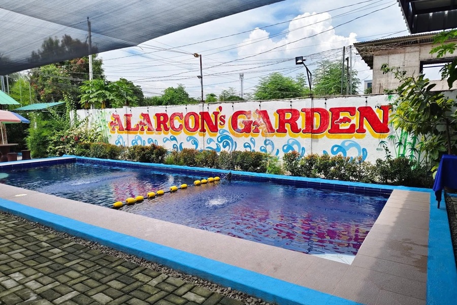
Here are some local spots to check out:
- Calumpang Dried Fish Complex: A busy hub for buying and selling dried fish, known for its strong local market activity.
- Savemore Market: A convenient neighborhood supermarket for groceries and daily essentials.
- Robinsons Supermarket: A modern grocery store serving residents along the main Calumpang commercial strip.
- Alarcon’s Garden: A small garden venue used for events, gatherings, and casual family celebrations.
Barangay Calumpang is one of the most important coastal and industrial barangays in General Santos City. It is strongly associated with the city’s fish port area, seafood processing, logistics, and port-related economic activity.
Because of this, Calumpang plays a major role in GenSan’s reputation as the Tuna Capital of the Philippines.
The barangay has a working, industrial character, with areas connected to fishing vessels, cold storage, canning, transport, warehousing, and other support businesses tied to the seafood trade.
At the same time, Calumpang also has residential communities, schools, churches, stores, eateries, and public facilities that support everyday life for workers and families living in the area.
Calumpang is significant because it shows the economic engine behind much of GenSan’s identity. While visitors often experience tuna through restaurants and markets, Calumpang is closer to the actual movement of fish, labor, processing, and export activity.
It is a barangay where coastal livelihood, industrial work, and urban settlement exist side by side.
7. Barangay City Heights
Here are some local spots to check out:
- Dadiangas Medical Center: A major private hospital providing full medical services to the city.
- Mindanao Medical Center: A multi‑specialty medical facility offering outpatient and diagnostic care.
- Jollibee: A popular fast‑food stop located along the main commercial road.
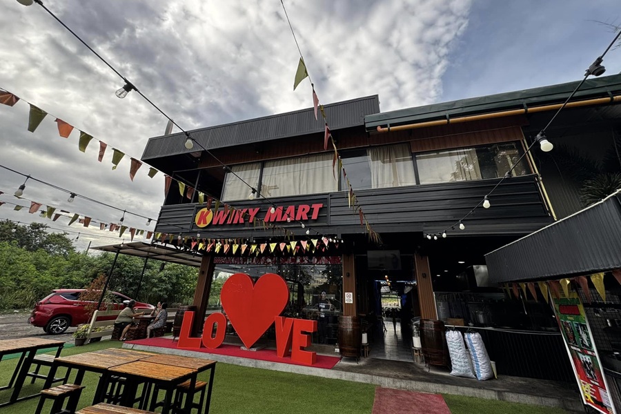
- Kwiky Mart Hway: A lively nightlife spot with darts, pool, live bands, and daily evening hangouts.
- Maldita Bar: A local nightlife spot known for casual drinks and live music.
Barangay City Heights is one of the major residential barangays of General Santos City and is known for its elevated location compared with the lower parts of the city.
Its name reflects its position on higher ground, giving parts of the barangay a more open and spacious feel. Over the years, City Heights has developed into a large settlement area with subdivisions, family homes, schools, churches, local businesses, and community facilities.
The barangay is important in GenSan’s residential expansion because it accommodates a significant number of households outside the central business district.
It has a mix of established neighborhoods and newer housing developments, making it home to students, workers, professionals, and families. Roadside stores, eateries, small service businesses, and transport routes support daily activity in the area.
City Heights is not primarily an industrial or tourist barangay, but it is one of the city’s key living districts. Its value comes from its role as a broad residential zone that reflects GenSan’s growth toward higher inland areas, where housing, schools, and neighborhood services continue to shape everyday urban life.
8. Barangay Conel
Here are some local spots to check out:
- Sanchez Peak: A well‑known viewpoint offering sunrise and cityscape views.
- Aqua Tierra Maze Garden: A landscaped garden with a maze‑style layout, popular for photos and family visits.
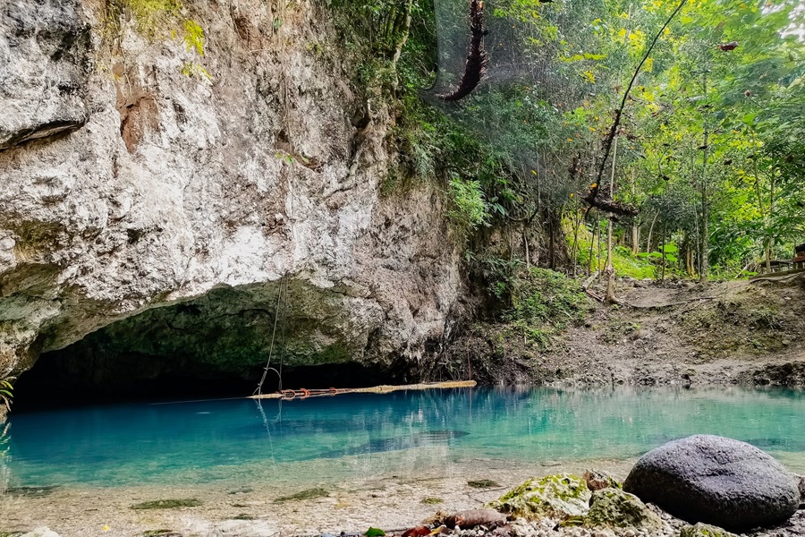
- Olarte Cave: A small but interesting cave system used for short spelunking and nature walks.
- Buko‑Buko Peak: A scenic hilltop viewpoint known for its coconut‑lined trails and wide city views.
- Brigada Waterfalls: A modest forest waterfall near the Conel–Olympog border.
- Conel Nature Park: Small community nature spots used for picnics and weekend gatherings.
Barangay Conel is one of the inland barangays of General Santos City, located farther from the dense commercial core and closer to the city’s upland and agricultural areas.
It has a more open, rural, and spacious character compared with the central barangays, with areas used for farming, residences, local roads, and community facilities.
Conel is significant because it shows the agricultural and less urbanized side of GenSan. While the city is often known for tuna, trade, and urban growth, barangays like Conel remain connected to land-based livelihood and rural settlement.
The area includes homes, small farms, churches, schools, sari-sari stores, and barangay facilities that serve local residents. Its location also makes it part of the transition zone between urban General Santos and the more interior landscapes surrounding the city.
Development in Conel is generally more spread out, with wider spaces and a quieter environment. The barangay’s value lies in its rural character, agricultural activity, and role in balancing GenSan’s identity as both an urban center and a city with large inland communities.
9. Barangay Dadiangas East
Here are some local spots to check out:
- Oval Plaza: The city’s main events and recreation park, known for festivals, sports, and open‑air activities.
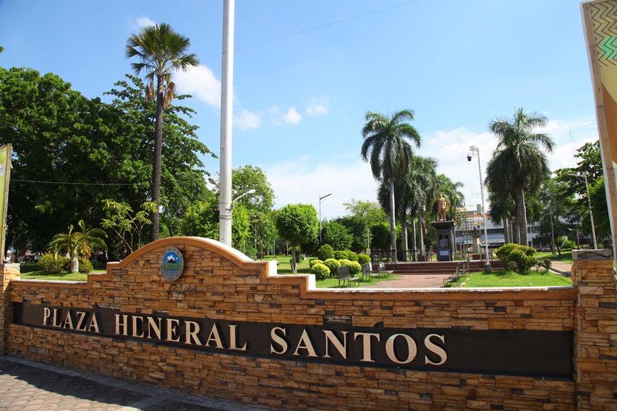
- Plaza General Santos: A central public plaza with monuments, gardens, and wide walking areas.
- ZIP Bar & Lounge: A trendy nightlife spot offering cocktails, music, and a relaxed evening vibe.
- Home Solutions Depot Plus: A large home‑improvement store for furniture, fixtures, and renovation needs.
- Flatspot (Drake’s Café): A popular hangout café known for coffee, snacks, and a skater‑friendly vibe.
- Jollibee: A busy fast‑food stop along the main commercial strip.
Barangay Dadiangas East is one of the urban barangays that form part of the older central area of General Santos City.
The name “Dadiangas” is historically important, as it is connected to the earlier identity of the place before the city became known as General Santos. Because of this, barangays carrying the Dadiangas name are closely tied to the city’s civic and settlement history.
Dadiangas East has a more urban character compared with the inland and coastal barangays. It is associated with residential neighborhoods, local businesses, schools, churches, offices, and access routes leading toward the commercial center.
Its location makes it part of the daily movement of workers, students, shoppers, and residents within the city proper.
The barangay’s value lies in its connection to GenSan’s older urban core. It reflects the city’s transition from early settlement and municipal development into a modern commercial center.
While it may not have the industrial profile of Calumpang or the coastal identity of Bula, Dadiangas East remains significant as part of the central barangay network that supports government access, commerce, education, and everyday city life.
10. Barangay Dadiangas North
Here are some local spots to check out:
- Phela Grande Convention Center: A major events venue used for conferences, weddings, and large gatherings.
- Bulaong Terminal: The main bus and van terminal connecting General Santos to regional destinations.
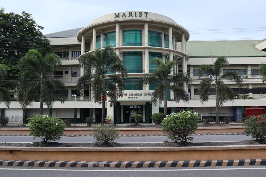
- Notre Dame of Dadiangas University (NDDU): A leading private university with a large campus in the barangay.
- Plainsight Gensan: A stylish nightlife spot with DJs, cocktails, neon ambience, and a strong late‑night crowd.
- Emcor Gensan: A well‑known appliance and electronics store along the main commercial strip.
Barangay Dadiangas North is one of the central urban barangays of General Santos City and part of the historic Dadiangas area.
The Dadiangas name is linked to the older name of the settlement, commonly associated with local history before the city was renamed in honor of General Paulino Santos. This gives Dadiangas North importance beyond its present-day urban function.
The barangay is located within the city proper and has a dense mix of residential, commercial, educational, religious, and service establishments.
Its central position makes it active throughout the day, with residents, students, workers, commuters, and shoppers moving through its streets. Small businesses, offices, schools, stores, eateries, and transport access all contribute to its urban character.
Dadiangas North is significant because it forms part of the working center of GenSan. It represents the city’s older built-up area, where settlement history, local commerce, and public life overlap.
Unlike the expanding suburban barangays, Dadiangas North is already deeply integrated into the city’s core, making it an important reference point for understanding central General Santos.
11. Barangay Dadiangas South
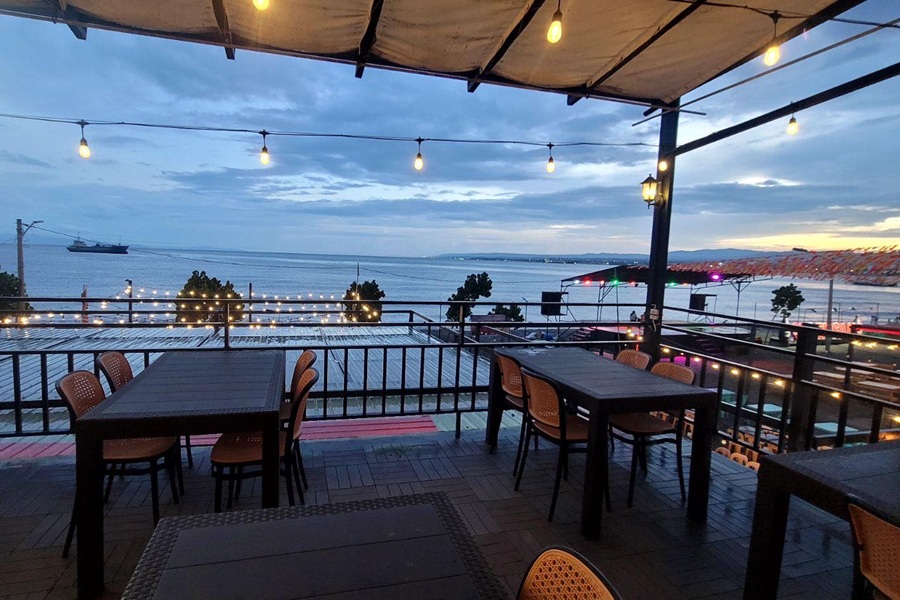
Here are some local spots to check out:
- South Bay: A row of open‑air restaurants with a shared central stage for nightly bands and singers. Lively and open late at night.
- Queen Tuna Park: The city’s public beach park, currently closed and under full reconstruction (the area is fenced off).
- MGM – General Santos: A supermarket‑style shopping center offering groceries, household items, and everyday essentials.
- Gensan Public Market: The city’s central market hub for seafood, produce, and local street food.
- Our Lady of Peace and Good Voyage Parish: A major Catholic parish located near the heart of the barangay.
Barangay Dadiangas South is one of the central barangays of General Santos City and part of the historic Dadiangas area.
The name “Dadiangas” is strongly connected to the city’s earlier identity, before General Santos became known under its present name. This gives Dadiangas South a historical layer that links it to the older settlement and civic development of the city.
Today, Dadiangas South has a busy urban character. It is located within the city proper and is associated with residential neighborhoods, commercial establishments, schools, churches, offices, transport routes, and small service businesses.
Its central location makes it part of the daily movement of students, workers, shoppers, and residents across GenSan. The barangay is significant because it helps form the city’s older urban core.
Unlike newer residential barangays on the outskirts, Dadiangas South is part of the built-up center where many aspects of city life overlap: commerce, public services, education, transport, and community activity.
It represents the more established side of General Santos, where the city’s historical identity and modern urban routines continue to meet.
12. Barangay Dadiangas West
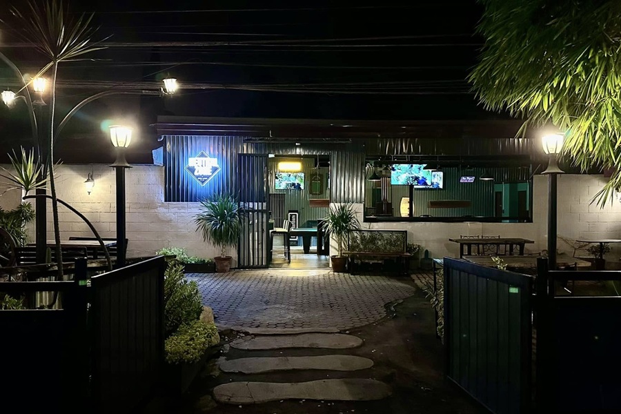
Here are some local spots to check out:
- FitMart Gensan: A long‑established department store offering affordable clothing, home goods, and daily essentials.
- Neutral Zone Bar: A casual nightlife spot with drinks, music, and pool tables for late‑night hangouts.
- GSCPO Firing Range: A police‑operated firing range used for training and recreational shooting.
- Gensan Budget Bikes: A go‑to shop for budget‑friendly bicycles, parts, and repairs.
- General Santos Doctors Medical School Foundation: A medical school campus located within the barangay’s educational zone.
Barangay Dadiangas West is one of the central urban barangays of General Santos City and part of the historically important Dadiangas area.
The name “Dadiangas” comes from the older name associated with the settlement before the city became General Santos, making the barangay part of the city’s early civic identity.
Dadiangas West has a strongly urban setting, with a mix of residential areas, commercial establishments, offices, schools, religious institutions, transport activity, and local services.
Because of its location in the city proper, it is closely connected to GenSan’s commercial and administrative life. The barangay supports daily movement between neighborhoods, markets, workplaces, schools, and central business areas.
Its value lies in its role as part of the old city center. Dadiangas West reflects the dense, active, and practical side of General Santos, where older settlement patterns have developed into a modern urban environment.
It may not be defined by coastline or agriculture, but it is important as one of the barangays that anchors the city’s central identity and everyday public life.
13. Barangay Fatima
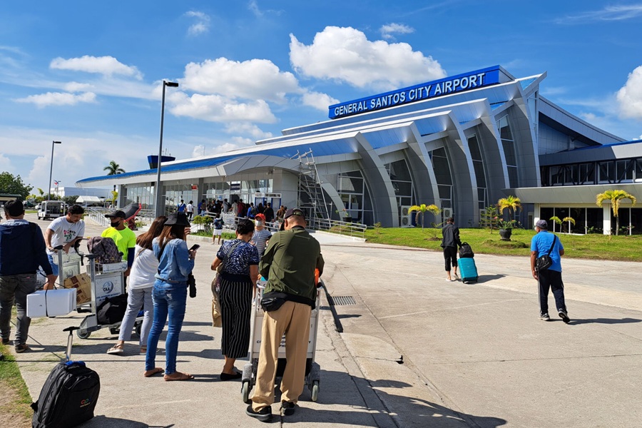
Here are some local spots to check out:
- General Santos International Airport: The city’s main airport, serving domestic flights with modern facilities and easy highway access.
- Mindanao State University: A major public university known for its wide campus, academic programs, and cultural events.
- Antonio C. Acharon Memorial Park: A spacious public park with open lawns, pathways, and community activity areas.
- Our Lady of Fatima Parish: A central Catholic parish serving the Fatima community with regular masses and local events.
Barangay Fatima is one of the larger inland barangays of General Santos City and is known for its strong residential character. It has become an important settlement area as the city has expanded outward from the central business district.
The barangay includes subdivisions, housing communities, schools, churches, local stores, eateries, and community facilities that support everyday family life.
Fatima is also associated with major road access and movement toward other inland parts of the city. This gives it a steady flow of commuters, students, workers, and residents traveling between home, school, work, and commercial areas.
While it is less dense than the older Dadiangas barangays, it has grown into one of the city’s active residential zones.
The barangay’s value lies in its role in GenSan’s suburban expansion. It reflects how the city has developed beyond its old urban core into wider inland communities.
Fatima is not primarily defined by tourism, industry, or coastal livelihood, but by housing, neighborhood services, schools, and local commerce. It is one of the barangays that show the everyday residential growth of modern General Santos.
14. Barangay Katangawan
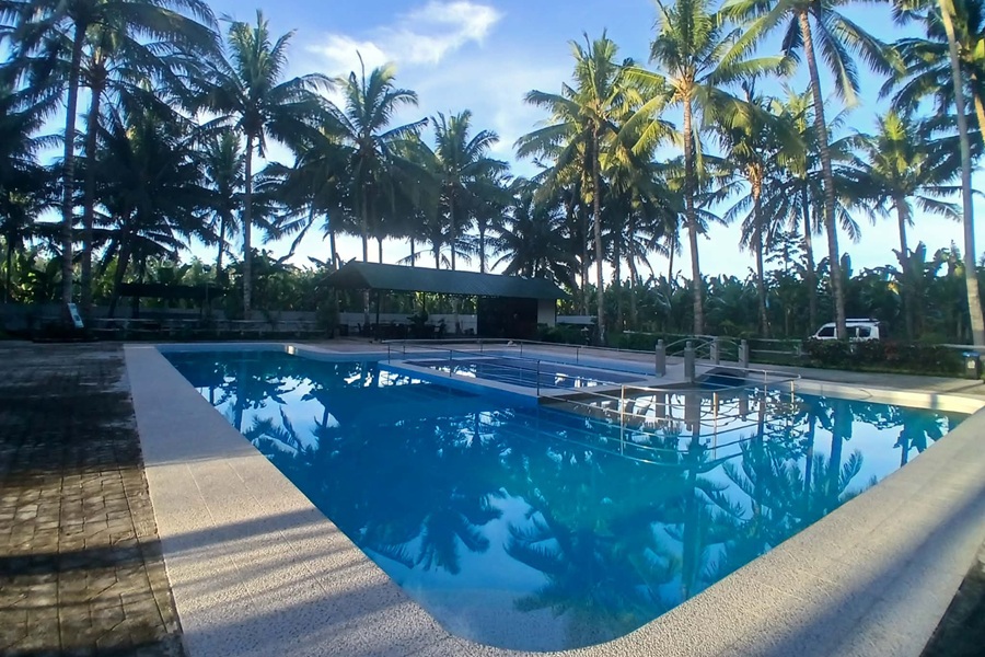
Here are some local spots to check out:
- Angkol Resorts: A family‑friendly resort with pools, cottages, and open spaces ideal for weekend gatherings and casual swimming.
- Felicidad Orchard and Garden Organics: A peaceful farm‑style garden offering organic produce, orchard walks, and a relaxing countryside atmosphere.
- SunJJay’s Haven Place and Resort: A private resort known for its clean pools, landscaped grounds, and quiet setting away from the city noise.
- AJ Edible Garden Resort: A garden‑themed resort combining swimming areas with edible plant gardens, perfect for families and small events.
Barangay Katangawan is an inland barangay of General Santos City with a more open and developing character compared with the central urban barangays.
It is located away from the busiest commercial districts and is associated with residential areas, agricultural land, local roads, small businesses, and community facilities.
Katangawan forms part of the wider inland landscape of GenSan, where urban growth meets more spacious settlement patterns.
The barangay includes homes, small farms, schools, chapels, sari-sari stores, and local service establishments that support the needs of residents.
Its environment is generally less crowded than the city center, with more room for gradual residential and community development. The barangay is significant because it represents the less commercial but still important side of General Santos.
While the city is widely known for ports, tuna, malls, and business activity, Katangawan shows how much of GenSan is also shaped by inland barangays where agriculture, housing, and local community life remain closely connected.
15. Barangay Labangal
Here are some local spots to check out:
- Wilcon Depot: A large home‑improvement and construction supply store offering building materials, tiles, fixtures, and hardware essentials.
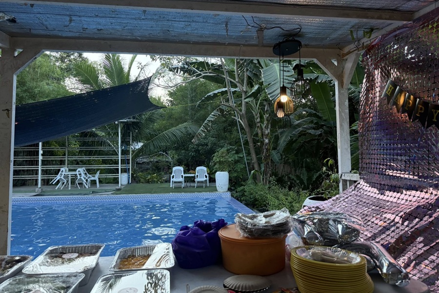
- Belmar Hidden Paradise: A quiet resort tucked inside Labangal, featuring pools, cottages, and a relaxed atmosphere for family gatherings.
- G Family Resort: A family‑friendly swimming resort with open spaces and private areas ideal for celebrations and weekend outings.
- Tropicatuna Food Products: A local tuna processing facility known for producing canned and bottled tuna products from General Santos’ fishing industry.
Barangay Labangal is one of the coastal barangays of General Santos City and plays an important role in the city’s fishing and maritime landscape.
Its location near Sarangani Bay connects it to coastal livelihood, seafood movement, residential communities, and routes leading toward other shoreline areas. Like nearby coastal barangays, Labangal has a character shaped by both settlement and the sea.
The barangay includes residential neighborhoods, small businesses, schools, churches, local eateries, and community facilities. Its coastal position gives it connections to fishing families, small-scale marine activity, and businesses that support daily life near the bay.
Depending on the area, Labangal can feel both residential and working-class, with households, vendors, transport activity, and local services closely tied together.
Labangal is significant because it reflects GenSan’s identity as a coastal city beyond the major fish port and industrial zones. It shows the community side of the shoreline, where everyday life is linked to the bay through livelihood, movement, food, and settlement.
Its value is in its role as one of the barangays that connect residential GenSan with the city’s coastal environment.
16. Barangay Lagao
Here are some local spots to check out:
- KCC Mall of Gensan: One of the city’s biggest malls, known for its department store, supermarket, cinemas, and wide dining options.
- Veranza Mall: A lifestyle mall connected to KCC, featuring open‑air dining, cafés, boutiques, and events.
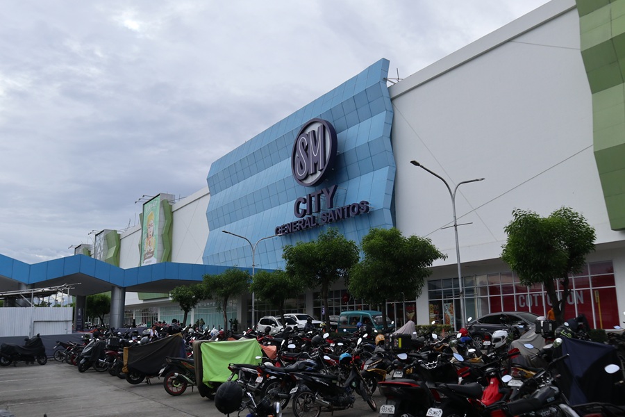
- SM City General Santos: A major shopping mall with national brands, restaurants, and a large supermarket.
- Robinsons Place General Santos: A major shopping mall in Lagao with cinemas, restaurants, retail stores, and essential services.
- Lagao Public Market: A bustling market known for fresh produce, seafood, meat, and local street food stalls.
- Lagao Gymnasium: A large covered court used for sports events, tournaments, and barangay activities.
- Lagao Central Park Area: Open spaces and community zones used for gatherings, sports, and weekend activities.
Barangay Lagao is one of the most established and recognizable barangays of General Santos City.
It functions as a major urban and commercial district, with a strong mix of residential neighborhoods, schools, churches, offices, restaurants, stores, transport routes, and public facilities.
Because of its location and level of development, Lagao is one of the barangays most closely associated with GenSan’s modern city life outside the old Dadiangas core.
Lagao has long been important as a settlement and activity area. Today, it includes busy roads, commercial strips, subdivisions, local markets, food establishments, and institutions that serve residents from different parts of the city.
Its accessibility makes it a regular destination for shopping, dining, schooling, errands, and commuting. The barangay is significant because it shows how GenSan has developed multiple urban centers rather than relying only on the downtown area.
Lagao combines neighborhood life with strong commercial activity, making it one of the city’s most active and practical barangays. It is both a place to live and a place where many people go for daily needs.
17. Barangay Ligaya
Here are some local spots to check out:
- Alamada Store: A long‑standing neighborhood convenience store serving residents and travelers passing through Ligaya’s main road.
- Huge Japanese Bunker: A large World War II–era Japanese bunker hidden in the hills of Ligaya, known for its thick concrete structure and historical significance.
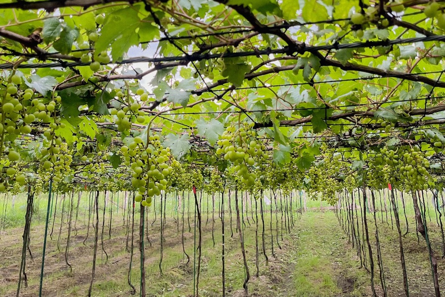
- Grapes Field Vinery: A small vineyard‑style farm offering grape plants, fruit harvests, and a unique agricultural experience.
- RAP Quarry: An active quarry site supplying aggregates and construction materials, reflecting the barangay’s industrial side.
Barangay Ligaya is one of the inland barangays of General Santos City, located away from the more commercial and coastal sections of the city.
It has a quieter and more spacious character, with areas shaped by residential communities, agricultural land, local roads, and small neighborhood businesses. Ligaya has a more rural atmosphere and reflects the inland side of GenSan’s development.
The barangay includes homes, farms, chapels, schools, sari-sari stores, small eateries, and basic community facilities that serve local residents.
Its environment is generally less dense, with open spaces and settlement patterns that are more spread out than in the city proper. This makes Ligaya part of the city’s broader agricultural and residential landscape.
Ligaya is significant because it shows that General Santos is not only an urban coastal economy, but also a city with large inland communities where land-based livelihood and neighborhood life remain important.
Its value comes from its open character, local agriculture, and role in connecting GenSan’s urban growth with its more rural barangays.
18. Barangay Mabuhay
Here are some local spots to check out:
- Amsikong 7 Falls: A natural multi‑tier waterfall system tucked deep in the upland area of Mabuhay, known for its rugged trails, cold water basins, and untouched forest surroundings.
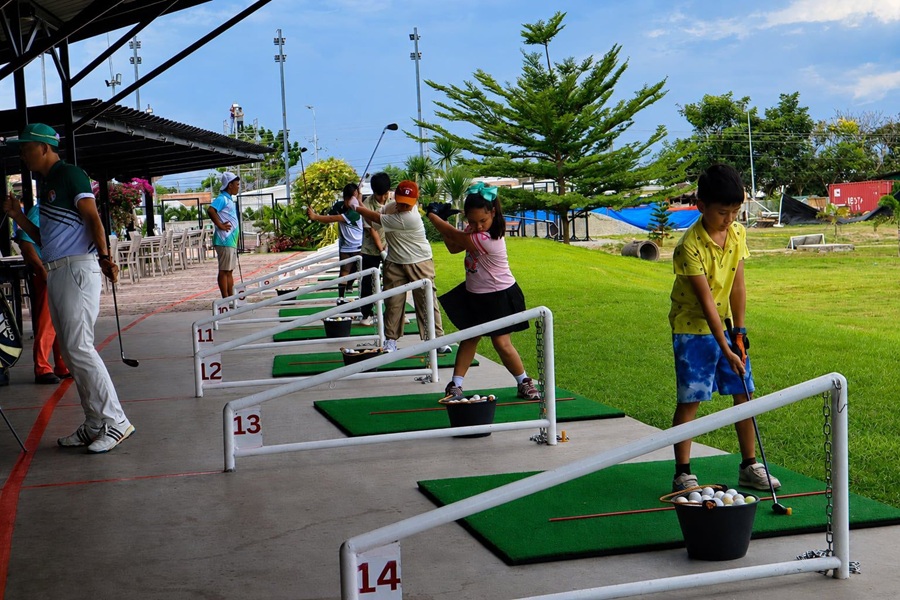
- Brigada Golf Range: A driving range operated under the Brigada group, offering open practice bays for golfers of all levels.
- Ka‑ilajan Farm Resort: A farm‑style resort with native cottages, open gardens, and a peaceful rural atmosphere.
- Hill VI: A scenic hilltop area in Mabuhay known for its elevated views, cool breeze, and quiet surroundings.
- Capanna Cavana: A rustic rest‑house–style spot offering a cozy, nature‑themed ambiance.
- Sky Camp: An elevated campsite and viewpoint offering panoramic views of the surrounding hills.
Barangay Mabuhay is one of the inland barangays of General Santos City and is associated with residential growth, local agriculture, and community-based development.
It is located outside the busiest commercial districts, giving it a more open and less crowded setting compared with the central barangays.
The barangay has a mix of homes, small farms, local businesses, schools, churches, sari-sari stores, and community facilities. Its development is shaped by both settlement and land use, with areas that remain agricultural alongside growing residential communities.
This combination gives Mabuhay a practical inland character, where daily life is connected to both neighborhood services and open land.
Mabuhay is important in understanding the wider geography of GenSan. While the city is often identified with tuna, ports, and commercial centers, barangays like Mabuhay show the continuing role of inland communities in the city’s growth.
It is a barangay where residential expansion, agriculture, local roads, and community facilities come together, reflecting the broader development of General Santos beyond its coastal and downtown areas.
19. Barangay Olympog
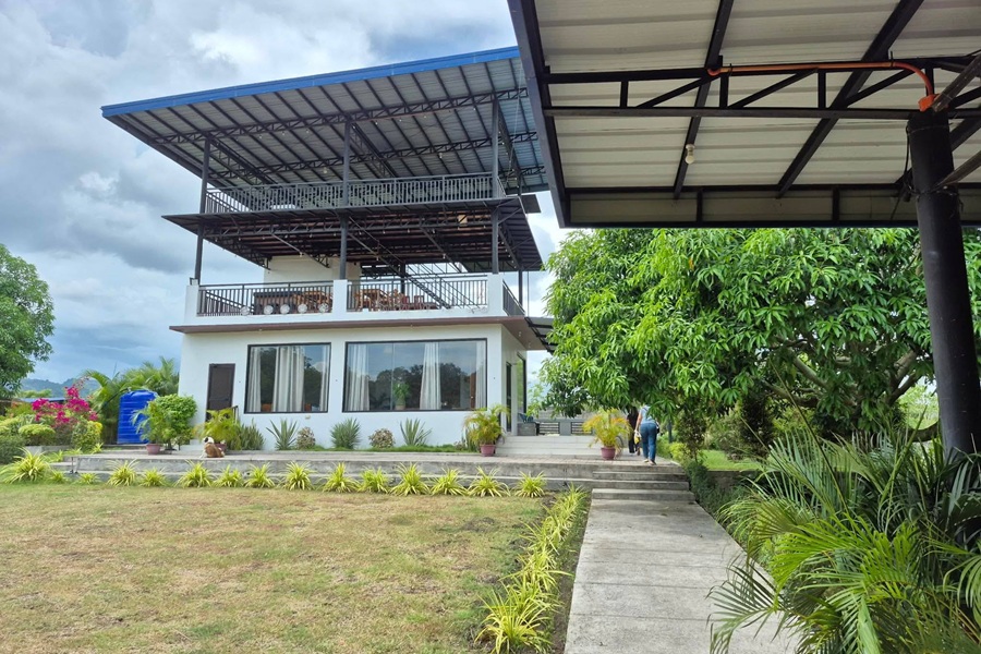
Here are some local spots to check out:
- Catulpos Ridge: A scenic ridge in the upland zone of Olympog, known for its panoramic views, cool breeze, and photo‑friendly hilltop terrain.
- ERC Resort: A private resort offering pools, cottages, and open spaces for family gatherings and events.
- TataHills: A hilltop rest area and viewpoint with rustic huts, open grassy slopes, and wide views of the surrounding mountains.
- SanHaven Park Pool: A family‑friendly swimming spot with landscaped surroundings, picnic areas, and a relaxed rural vibe.
- Miteche Mango Farm: A mango orchard and farm area offering fresh produce, open fields, and a peaceful agricultural setting.
- Papa Cardz’ Family Resort: A private resort with pools, cottages, and event spaces, ideal for reunions and group outings.
- MV’s Place Events and Private Pool: A modern private pool venue designed for events, parties, and exclusive bookings.
Barangay Olympog is one of the inland barangays of General Santos City, located away from the city’s dense commercial and coastal areas. It has a more rural and open character, with land used for homes, small farms, local roads, and community facilities.
Compared with the central barangays, Olympog is less urbanized and reflects the wider interior landscape of the city.
The barangay’s everyday environment includes residential clusters, agricultural areas, chapels, schools, sari-sari stores, small eateries, and barangay facilities.
Its development is generally more spread out, with open spaces and local roads connecting households and farming areas. This gives Olympog a quieter setting compared with more built-up parts of GenSan.
Olympog is significant because it represents the agricultural and inland side of General Santos. While the city is strongly known for tuna, trade, and urban growth, barangays like Olympog show that GenSan also includes communities where land, farming, and neighborhood life remain central.
Its value lies in its rural character, local settlement patterns, and role in the city’s broader geographic and community landscape.
20. Barangay San Isidro
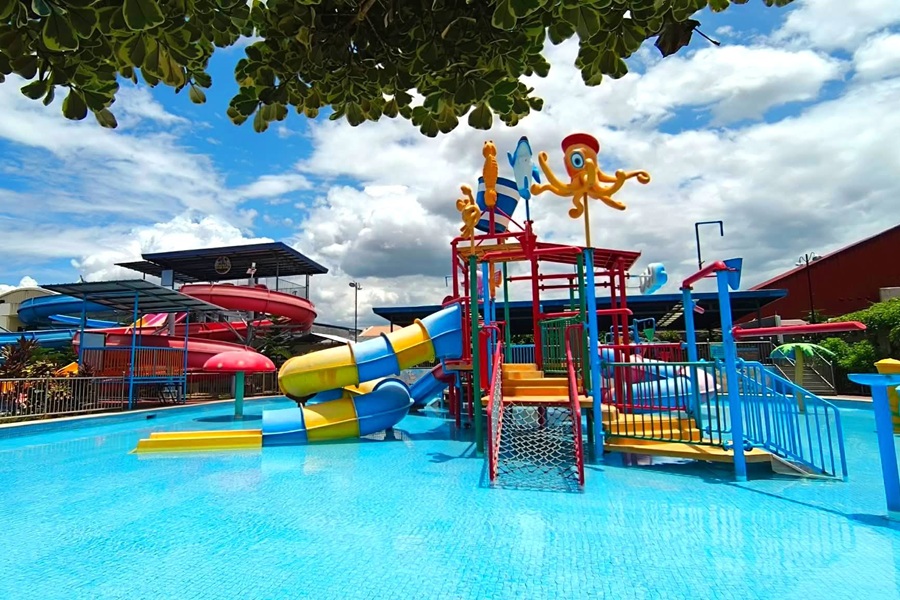
Here are some local spots to check out:
- Eden’s Hidden Place and Garden: A peaceful garden‑style venue with native cottages, landscaped greenery, and a quiet atmosphere.
- Savemore Market: A busy neighborhood supermarket serving the entire San Isidro area, surrounded by eateries, shops, and residential blocks.
- Aicka Water Park: A family‑friendly water park featuring pools, slides, and open spaces for birthdays and weekend outings.
- D Sanctum Resort: A private resort with modern pools, event areas, and cozy cottages.
- Pinnoy Stars Convention Center & Resort: A large events venue and resort offering function halls, pools, and wide outdoor spaces.
Barangay San Isidro is one of the major residential barangays of General Santos City and is associated with the city’s inland expansion.
It has developed into an important settlement area with subdivisions, housing communities, schools, churches, local businesses, and community facilities.
Its location outside the dense central core gives it a suburban character while still maintaining access to the city’s main activity areas.
San Isidro includes a mix of established neighborhoods and newer residential developments. Roadside stores, eateries, service shops, transport routes, and public facilities support daily life for residents.
The barangay is also connected to local mobility, with people moving through it for school, work, errands, and access to nearby barangays.
Its significance comes from its role in GenSan’s residential growth. San Isidro reflects the city’s shift from a compact urban center into wider suburban communities.
It is not defined by tourism or heavy industry, but by housing, schools, neighborhood services, and the practical needs of families and workers who live in the inland parts of the city.
21. Barangay San Jose
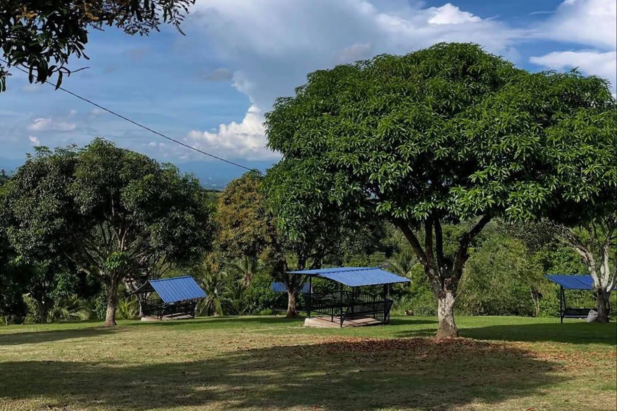
Here are some local spots to check out:
- Bagong Silang Hot Spring: A natural hot spring known for its warm water pools and rustic, undeveloped surroundings, it’s a local favorite for simple relaxation.
- Angela’s Resort: A small private resort offering pools, cottages, and open spaces for family gatherings.
- Avery’s Resort: A family‑friendly resort with swimming pools and event areas, commonly used for birthdays and weekend outings.
- View Bia‑o: A scenic hilltop viewpoint overlooking the surrounding mountains and farmlands. Popular for sunrise watching, photoshoots, and quiet nature visits.
Barangay San Jose is one of the inland barangays of General Santos City, located outside the dense commercial center and closer to the city’s more spacious interior areas.
It has a quieter and more rural character compared with the central Dadiangas barangays, with land used for homes, farming, local roads, and community facilities.
The barangay includes residential clusters, agricultural areas, chapels, schools, sari-sari stores, small eateries, and other neighborhood services. Its settlement pattern is generally more spread out, giving it a less crowded atmosphere than the city proper.
This makes San Jose part of GenSan’s broader inland landscape, where agriculture and residential life continue to exist alongside gradual development.
San Jose is significant because it reflects the land-based side of General Santos. While the city is often known for its coastal economy and urban growth, barangays like San Jose show the importance of rural communities within the city’s boundaries.
Its value lies in its open environment, agricultural activity, and role as part of the city’s interior barangay network.
22. Barangay Siguel
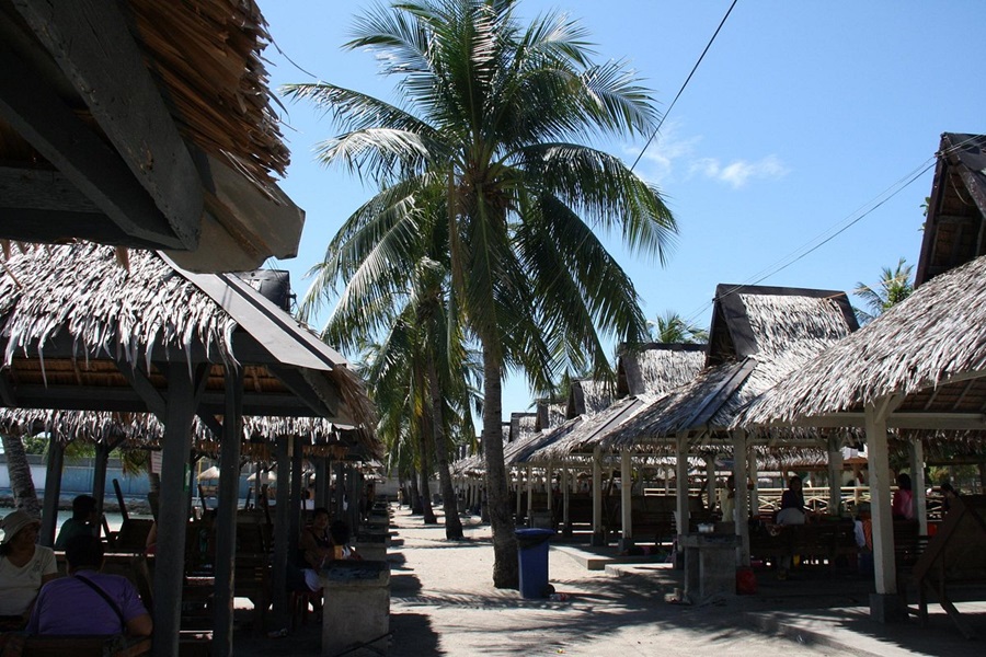
Here are some local spots to check out:
- London Beach Resort: A beachfront resort along Siguel’s coastline offering cottages, swimming areas, and direct access to Sarangani Bay.
- Watergran Resort Corporation: A private resort complex featuring pools, event spaces, and landscaped surroundings.
- Woodcliff Farm: A farm property offering open fields, fruit-bearing trees, and a peaceful rural environment typical of the barangay’s agricultural zone.
- Caramihan Ranch: A ranch‑style property with wide grasslands, livestock areas, and scenic countryside views.
- RA ZO Shooting Range: A licensed outdoor shooting range used for firearms practice, safety training, and sport shooting activities.
Barangay Siguel is one of the coastal barangays of General Santos City, positioned along the city’s southwestern side facing Sarangani Bay. Its location gives it a distinct character compared with the more urban barangays near the city center.
Siguel is closely associated with fishing, coastal settlement, small-scale trade, and road access toward the city’s outer shoreline communities.
The barangay’s geography is shaped by its relationship with the bay, where marine livelihood, shoreline activity, and coastal movement remain important parts of daily life.
Historically, Siguel forms part of the wider coastal landscape that helped define early settlement and livelihood patterns in General Santos.
Before the city became known for large-scale tuna exports and urban growth, coastal communities like Siguel were already tied to fishing, sea travel, and local exchange.
Its terrain includes coastal areas, residential clusters, and inland sections that connect it to nearby barangays and routes leading toward Sarangani Province.
Today, Siguel remains a quieter but important part of GenSan’s barangay map. It represents the city’s coastal edge: less commercial than the central districts, but significant for its shoreline communities, marine-based livelihood, and connection to Sarangani Bay.
23. Barangay Sinawal
Here are some local spots to check out:
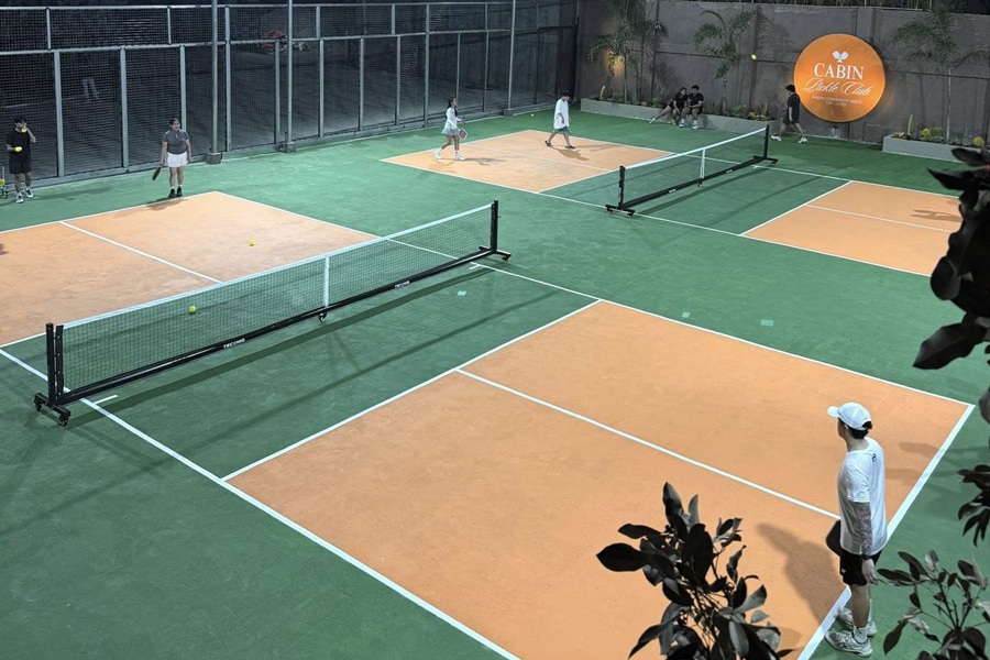
- The Cabin Brewery: A cozy, cabin‑style hangout spot in Sinawal known for its relaxed atmosphere, outdoor seating, and newly added two pickleball courts.
- Orchard Road Memorial Park Gensan: A large, landscaped memorial park with peaceful surroundings and well‑maintained grounds.
- Bujajorn Mountain Resort: A hillside resort offering scenic views, cool breezes, swimming pools, and cottages.
- Sinawal’s Best Hillside Café: A small café perched on a hillside, offering scenic views, coffee, and light meals.
Barangay Sinawal is one of the inland barangays of General Santos City, located toward the more open and less urbanized side of the city. It has a rural and agricultural character, with land used for homes, farms, local roads, and community facilities.
Compared with the central barangays, Sinawal is more spacious and closely connected to land-based livelihood.
The barangay includes residential areas, agricultural spaces, schools, chapels, sari-sari stores, small eateries, and barangay facilities that serve local residents.
Its landscape is generally more spread out, with communities connected by interior roads rather than dense commercial streets. This gives Sinawal a quieter environment and a stronger connection to farming and rural settlement.
Sinawal is significant because it shows the agricultural dimension of General Santos City. While GenSan is widely recognized for tuna, ports, and trade, barangays like Sinawal show that the city also has large inland areas where farming, open land, and community life remain important.
Its value lies in its role as part of the city’s rural interior and in the balance it gives to GenSan’s coastal and urban identity.
24. Barangay Tambler
Here are some local spots to check out:
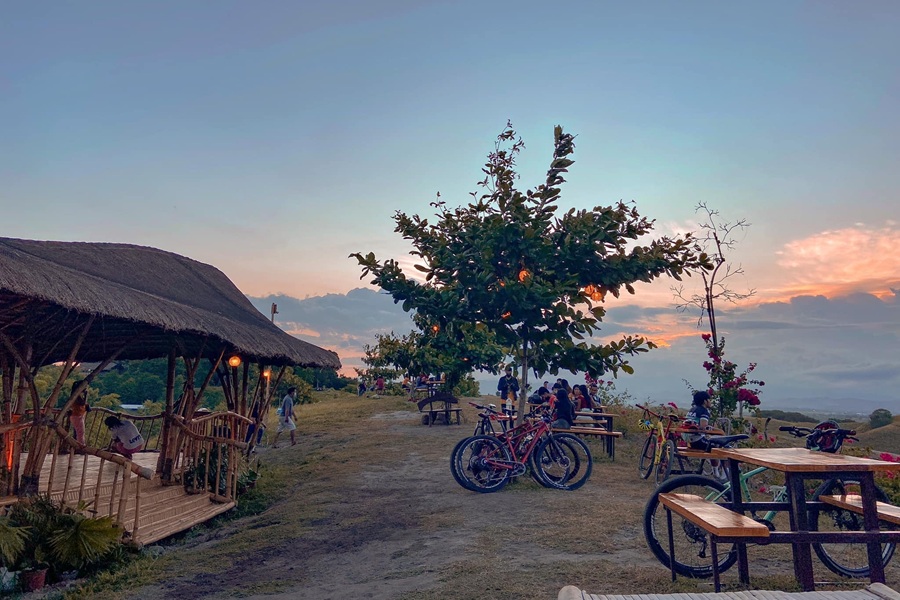
- General Santos City Fish Port Complex: The largest tuna port in the Philippines and one of the biggest in Southeast Asia.
- Sarangani Highlands Garden: A famous hilltop garden‑restaurant offering panoramic views of Sarangani Bay.
- Tropicana Beach Resort: A beachfront resort along Tambler’s coastline with cottages, swimming areas, and direct access to the bay.
- Buntod Gensan: A campground‑style outdoor venue with cottages, open grassy areas, and simple facilities for group gatherings, picnics, and overnight stays.
- D Garden Calatao: A garden‑style events venue and leisure area featuring landscaped surroundings, open spaces, and a peaceful atmosphere.
Barangay Tambler is one of the coastal barangays of General Santos City and is closely connected to the city’s fishing, port, and industrial economy.
Its location near Sarangani Bay gives it direct importance in maritime activity, seafood handling, transport, and businesses that support the movement of goods. Tambler is also associated with access to important coastal and industrial zones in the city.
The barangay has a mix of residential communities, industrial establishments, warehouses, seafood-related businesses, local stores, eateries, schools, churches, and community facilities.
Its coastal position gives it a working character, especially in areas connected to fishing vessels, logistics, processing, and support services. Tambler is significant because it forms part of the economic side of coastal GenSan.
While some coastal barangays are more residential, Tambler is strongly tied to the city’s productive landscape, where port access, seafood activity, industrial sites, and transport routes come together.
It plays an important role in the larger system that supports GenSan’s identity as a major fishing and trade center in Southern Mindanao.
25. Barangay Tinagacan
Here are some local spots to check out:
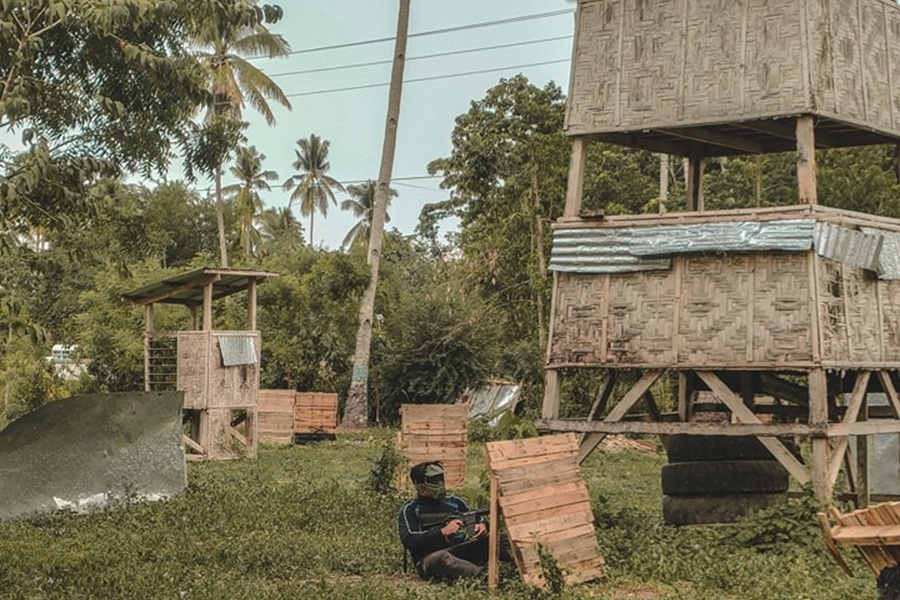
- Delta Force Airsoft Gamesite: An outdoor airsoft field located in the upland interior of Tinagacan. Known for its forested terrain, natural cover, and scenario‑based games.
- CVS Farm Resort: A farm‑style private resort offering pools, cottages, and open green spaces. It sits deep within Tinagacan’s rural zone, giving it a quiet countryside atmosphere.
- Tinagacan Lake: A small, natural lakeside area located in the highlands of Tinagacan. Known for its calm waters, surrounding greenery, and simple, undeveloped setting.
Barangay Tinagacan is one of the inland barangays of General Santos City, located away from the city’s coastal and commercial center.
It has a more open and rural character, with areas used for farming, residential settlement, local roads, and community facilities. Its environment is generally less dense than the urban barangays, giving it a quieter and more spacious atmosphere.
Tinagacan includes homes, agricultural areas, chapels, schools, sari-sari stores, small eateries, and barangay facilities that serve the local population. Its development is closely tied to land use and community growth rather than heavy commercial activity.
The barangay’s roads connect residents to nearby inland barangays and to the wider city. Tinagacan is significant because it reflects the agricultural and interior side of General Santos.
While the city is often recognized for tuna, ports, malls, and urban business, Tinagacan shows that a large part of GenSan is still shaped by rural settlement, open land, and local farming.
Its value lies in its role as part of the city’s inland network of communities, where agriculture, family life, and gradual development continue to define the landscape.
26. Barangay Upper Labay
Here are some local spots to check out:
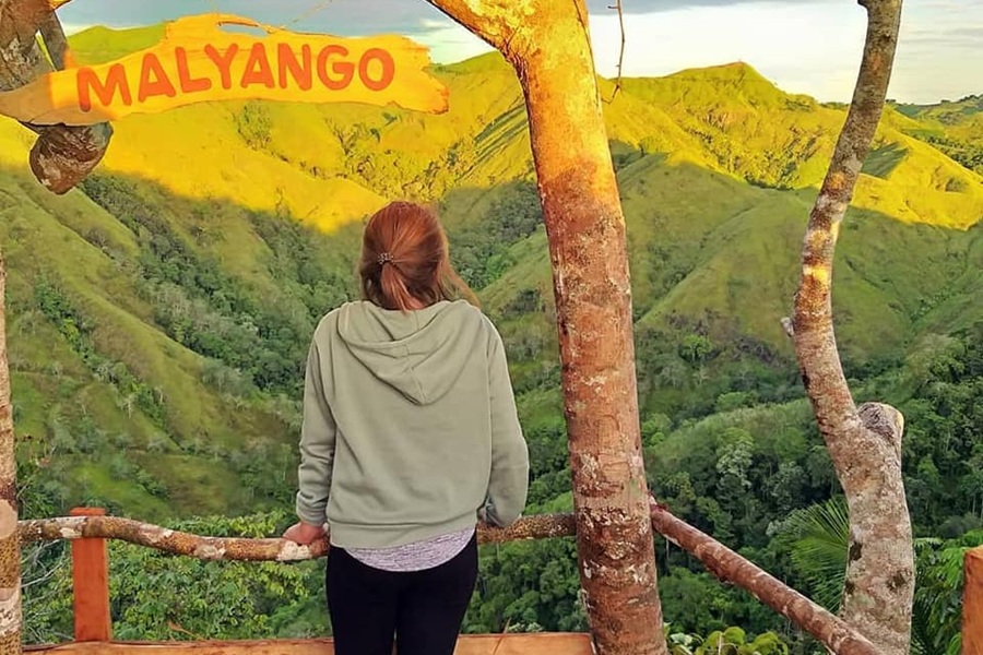
- Malyango Peak: A scenic highland viewpoint overlooking the surrounding valleys and the foothills of Mt. Matutum. Known for its cool air, grassy slopes, and quiet sunrise views.
- Pico de Pedro Rocky Peak: This is primarily a trail and rocky viewpoint, not a standalone mountain peak. It features rugged rock formations and short but steep sections, making it a good spot for light trekking and panoramic photos.
- Malyango Jumpoff Park Space: A simple open area used as the main jump‑off point for hikes toward Malyango Peak and nearby ridges. It serves as a staging spot for hikers, with open grounds, fresh air, and views of the surrounding uplands.
Barangay Upper Labay is one of the inland barangays of General Santos City and is located toward the city’s more elevated and interior areas.
As its name suggests, it is associated with higher ground compared with lower coastal and central barangays. This gives Upper Labay a more open, rural, and spacious character.
The barangay includes residential communities, agricultural land, local roads, chapels, schools, sari-sari stores, and community facilities.
Its setting is generally less urbanized, with wider spaces and a stronger connection to land-based livelihood. Farming and residential settlement are important parts of the barangay’s identity, along with local services that support everyday needs.
Upper Labay is significant because it shows the upland side of General Santos. It contrasts with the city’s coastal and industrial barangays by highlighting GenSan’s interior geography, where elevation, open land, and rural communities shape daily life.
Its value lies in its quieter environment, agricultural activity, and role in connecting the city to its higher inland areas.
Wrap-Up
General Santos City is best understood through the everyday life of its barangays. Each area carries part of the city’s identity, from coastal livelihood and trade to farming communities, residential growth, and older urban neighborhoods.
Together, they show how GenSan developed not as one uniform place, but as a city shaped by movement, work, settlement, and local history.
Looking barangays of General Santos gives a clearer view of the city beyond familiar labels and reveals the many communities that continue to define its character.