General Santos is often introduced as the Tuna Capital of the Philippines, but its history goes far deeper than fish ports, factories, and modern malls.
Long before it became one of Mindanao’s most important commercial cities, this area was known through older names like Dadiangas, Buayan, and Makar. The names that still appear in barangays, roads, local stories, and historical references today.
History of General Santos is shaped by indigenous Blaan communities, coastal trade, migration, agriculture, wartime disruption, postwar rebuilding, and the rise of a powerful fishing and export economy.
It is a city built around movement: people moving from uplands to coastlines, settlers arriving by boat, goods passing through the port, and tuna entering markets far beyond Mindanao.
General Santos History Timeline
This timeline walks you through the major turning points that shaped General Santos into the city visitors see today. We divided the history of General Santos into different eras:
- Era 1: Early Settlements, Dadiangas, and Sarangani Bay
- Era 2: Makar, Buayan, and the Making of a Town
- Era 3: The 1939 Settlement and Early Growth
- Era 4: War, Rebuilding, and Renaming
- Era 5: Cityhood and Economic Expansion
- Era 6: Tuna Capital, Regional Hub, and Modern GenSan
Before the 1800s
Blaan Communities Live Around the Area
Long before the city became General Santos, the area was home to Blaan communities. Their presence shows that the city’s history began with indigenous settlements connected to the land, coast, hills, and natural resources.
Pre-Colonial to Colonial Period
Dadiangas Becomes Part of a Wider Coastal World
The area known as Dadiangas was part of a broader coastal network around Sarangani Bay. Trade, movement, and contact with nearby communities shaped life here before modern city development.
Late 1800s
Spanish-Era Presence Reaches the Sarangani Bay Area
By the late Spanish period, colonial influence had reached parts of the Sarangani Bay area. This marked the beginning of stronger outside interest in the region, though local communities remained central to daily life.
1898
The Olarte Brothers Settle in Makar
In 1898, the Olarte brothers settled in Makar, one of the early communities near present-day General Santos. Their arrival reflects the gradual growth of permanent settlements around Sarangani Bay.
1903
The Municipality of Makar Is Established
Makar became a municipality in 1903, marking an early step in organizing local government in the area. It helped shape the administrative roots of what would later become General Santos.
1914
The Municipal District of Buayan Is Created
In 1914, Buayan was created as a municipal district. This expanded formal governance in the region and connected scattered settlements under a clearer local structure.
1924–1928
A Planned Market Settlement Begins to Take Shape
During this period, planning began for a new market-centered settlement in the Dadiangas area. This helped prepare the groundwork for future migration, trade, and urban growth.
February 27, 1939
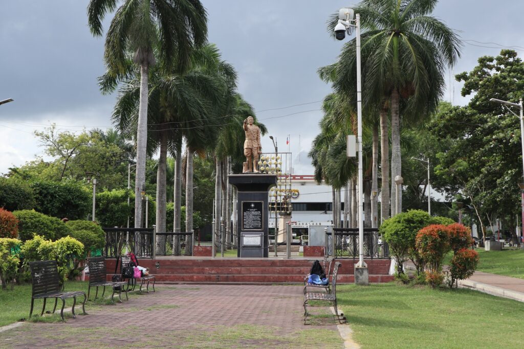
General Paulino Santos Arrives with the First Settlers
In February 1939, General Paulino Santos led the first organized settlers to the area. This marked a major turning point, as planned migration began shaping Dadiangas into a growing settlement.
1939
Lagao Becomes an Early Settlement Center
Lagao became one of the first settlement centers for the new arrivals. It played an important role in farming, community building, and the early expansion of the settlement area.
1940
Buayan Becomes an Independent Municipal District
In 1940, Buayan became an independent municipal district. This gave the area stronger local identity and administration as its population and settlements continued to grow.
1942–1945
World War II Reaches the Area
During World War II, the area was affected by Japanese occupation and conflict across Mindanao. The war disrupted local life, settlement growth, and early development.
August 18, 1947
Buayan Becomes a Regular Municipality
On August 18, 1947, Buayan became a regular municipality. This gave the area stronger political status and supported its growth as an organized local government.
January 1948
Irineo Santiago Becomes the First Municipal Mayor
In January 1948, Irineo Santiago became the first municipal mayor of Buayan. His leadership marked the beginning of formal municipal governance after its official recognition.
1954
Buayan Is Renamed General Santos
In 1954, Buayan was renamed General Santos in honor of General Paulino Santos. The new name reflected the settlement program that helped shape the city’s modern identity.
1959
Makar Wharf Becomes an Open Port of Entry
In 1959, Makar Wharf became an open port of entry. This strengthened trade and sea transport, helping connect the growing municipality to wider markets.
1963–1967
Agriculture and Industry Drive a Local Boom
During this period, agriculture and early industries helped push General Santos forward. Farming, trade, and processing activities supported faster growth and brought more opportunities to the area.
July 8, 1968
General Santos Officially Becomes a City
On July 8, 1968, General Santos was officially converted into a city. This marked a major milestone in its development from a settlement and municipality into an urban center.
September 5, 1968
The City of General Santos Is Inaugurated
On September 5, 1968, the newly created City of General Santos was formally inaugurated. The event celebrated the city’s new status and its growing role in southern Mindanao.
1970s–1980s
Fishing and Agriculture Strengthen GenSan’s Identity
In the 1970s and 1980s, fishing and agriculture became central to GenSan’s economy. These industries shaped the city’s reputation as a major source of food, trade, and livelihood.
September 5, 1988
GenSan Becomes a Highly Urbanized City
On September 5, 1988, General Santos became a highly urbanized city. This status recognized its rapid growth, expanding economy, and increasing importance in the region.
Early 1990s
GenSan Becomes Known as the Boom City of the South
In the early 1990s, General Santos gained attention for its fast economic growth. Expanding trade, industry, and investment helped earn it the nickname “Boom City of the South.”
Mid-1990s
The Tuna Industry Puts GenSan on the Global Map
By the mid-1990s, GenSan’s tuna industry had become one of its strongest economic symbols. Its fishing fleets, ports, and processors helped connect the city to international seafood markets.
1996
GenSan Hosts Major National and Regional Events
In 1996, General Santos hosted major events that raised its profile beyond the region. These gatherings showed the city’s growing capacity as a center for business, sports, and public life.
2000s
Malls, Transport, and Urban Services Expand
During the 2000s, GenSan saw continued growth in malls, transport, and city services. These changes made daily life more urban and supported its role as a regional hub.
2000s–2010s
Tuna Festival Becomes a Signature Celebration
Through the 2000s and 2010s, the Tuna Festival became one of GenSan’s most recognized celebrations. It highlighted the city’s fishing identity, local pride, and cultural energy.
2019
GenSan Gains Stronger Congressional Identity
In 2019, General Santos gained stronger congressional representation. This gave the city a clearer political voice and reflected its importance as a highly urbanized center.
2020s
Modern GenSan Balances Trade, Food, and City Life
Today, GenSan continues to grow as a center for trade, food production, and urban living. Its identity blends coastal industry, agricultural roots, and modern city development.
Why This History Matters Today
GenSan’s history is not hidden in museums alone. You can still see it in the city’s names, roads, barangays, industries, and everyday life.
Dadiangas Still Lives in the City’s Identity
Even though the city is now called General Santos, the name Dadiangas is still visible in barangays, schools, businesses, and local references. It connects modern GenSan to its older identity before cityhood and before the name General Santos became official.
Lagao Shows the Link Between Past and Present
Lagao is now one of GenSan’s busiest commercial areas, but it also connects to the early settlement period of 1939. When you visit KCC, Veranza, or the surrounding streets, you are in a barangay that played an important role in the city’s early organized growth.
Makar Explains GenSan’s Port Identity
The Makar area helps explain why the sea matters so much to the city. Long before GenSan became famous for tuna, its coastal position made it important for movement, trade, and settlement. Today, the port side of the city continues that role.
The Tuna Industry Is a Modern Historical Force
The tuna industry is not just part of GenSan’s economy. It is one of the main reasons the city became nationally and internationally known. Fish ports, canneries, exporters, restaurants, and festivals all carry this history forward.
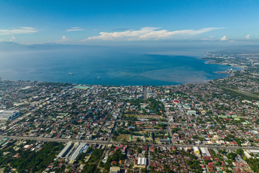
GenSan’s Growth Came from Its Location
General Santos grew because of where it sits: beside Sarangani Bay, near agricultural lands, connected to South Cotabato and Sarangani, and positioned as a gateway in southern Mindanao. Its geography shaped its history from the beginning.
Wrap-Up
General Santos may be young compared with older Philippine cities, but its history is rich, layered, and closely tied to the land and sea around it.
From Blaan roots and the old names of Dadiangas, Buayan, and Makar to the 1939 settlement, cityhood in 1968, and the rise of the tuna industry, GenSan’s story is one of movement, growth, and reinvention.
Understanding this history helps you see the city differently. GenSan is not just a stopover, a port, or a place to eat tuna. It is a city shaped by indigenous heritage, migration, trade, agriculture, fishing, and regional ambition; and those layers are still visible today.